
Heipaizhou Coastal Trekking 2026: Volcanic Rock Formations & Golden Hour Photography
Overview
– Heipaizhou (黑排角): 8 km volcanic rock coastline in Huidong County, eastern Guangdong
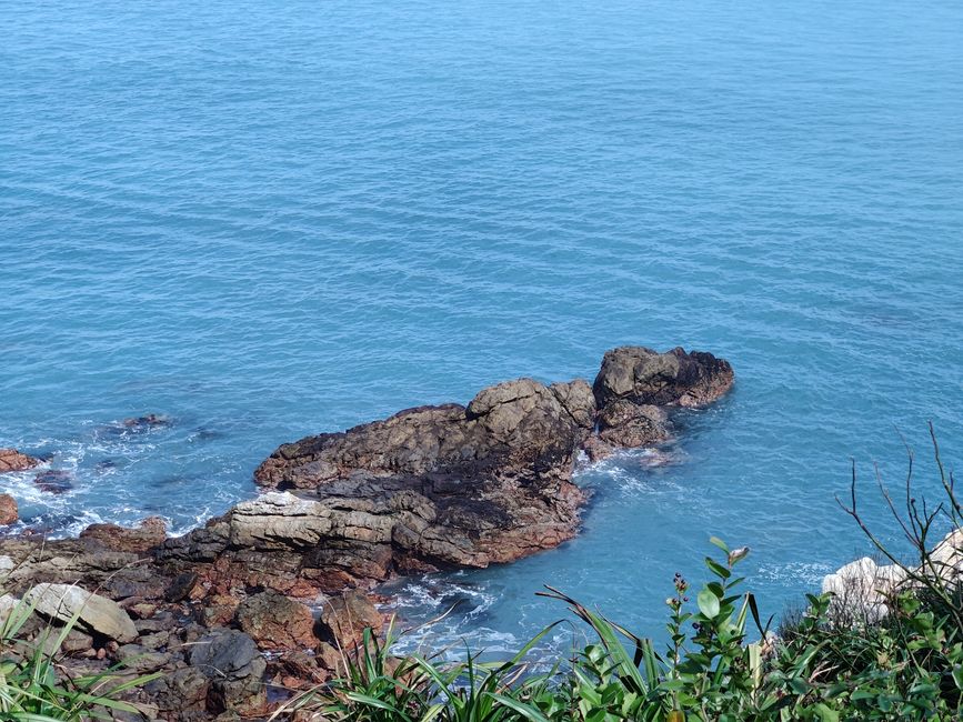
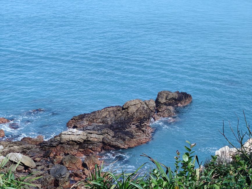
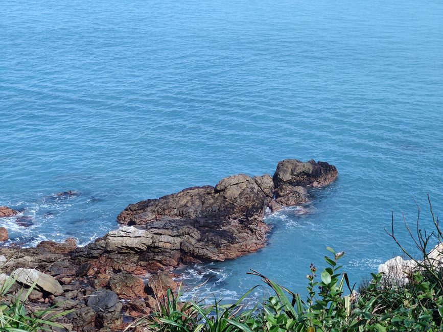
– Known for: 100-million-year-old basalt columns, dramatic tidal pools, sea arches — one of Guangdong’s most photographed coastlines
– Distance from Huizhou city: ~65 km, 1.2h drive; from Shenzhen: ~140 km, 2h
– Difficulty: moderate-hard; 16 km round-trip trek requires fitness and hiking experience
– Trail type: coastal wilderness; unmarked sections; scrambling over volcanic rock
– Permits: none required; free entry
What Makes Heipaizhou Exceptional
HEIPAIZHOU COASTAL scene — Huizhou, Guangdong
Heipaizhou (literally “Black Reef Corner”) exposes a 100-million-year-old volcanic seam at the coast. The black basalt columns are geologically similar to those at Giant’s Causeway in Northern Ireland and Devils Tower in Wyoming — but in a subtropical Guangdong setting with turquoise water and dense coastal vegetation.
For photographers, the combination of black basalt, emerald-green sea, and golden-hour light creates conditions found nowhere else in Guangdong. For hikers, the 8 km coastal trail offers one of the most dramatic wilderness treks in the Pearl River Delta — within day-trip range of Shenzhen and Guangzhou.
Geology: Why the Rocks Are Black
The Heipaizhou coastline was formed during the Late Cretaceous period (~100 million years ago) when volcanic intrusions cooled slowly beneath the seabed, forming hexagonal columnar jointing in the basalt. Subsequent sea-level changes and wave erosion exposed these columns at the coast.
The black color comes from iron-rich minerals in the basalt. When wet, the rocks appear almost metallic — making them particularly dramatic for photography during and after rain.
HEIPAIZHOU COASTAL view — Huizhou, Guangdong
Route Options
Full Trek — 8 km One-Way / 16 km Round-Trip (Recommended)
– Distance: 8 km one-way / 16 km round-trip
– Duration: 6–8 hours including photography stops and rest
– Start point: Nan’ao Village (南坳湾) — small free parking lot at trailhead
– Terrain: volcanic rock platforms (scrambling), tidal flat crossings, muddy sections after rain
– Difficulty: 4/5 stars — experienced hikers only; not suitable for children under 12
Route stages:
– 0–2 km: Compacted coastal path; gradual incline; first basalt column views
– 2–4 km: Technical scrambling begins; sea arches visible; tidal pools emerge
– 4–6 km: Most dramatic section — 20m sea cliffs, wave-cut platforms, highest columnar basalt density
– 6–8 km: Quieter section; coastal forest patches; exit at Dongping coastal road
Short Route — 3 km Round-Trip (2 Hours)
– Best for: photographers and casual hikers wanting iconic basalt column views
– Difficulty: 2/5 stars; family-friendly
Photography-Focused Route — 5 km Round-Trip (3–4 Hours)
– Best for: serious photographers wanting the full columnar basalt experience
– Difficulty: 3/5 stars
Key Formations Along the Trail
– The Organ Pipes (km 3.5): most photographed basalt formation; 30m-high columnar cliff face
– The Natural Sea Arch (km 4.2): 10m-high natural arch carved by waves; best at low tide
– The Tide Pool Garden (km 3.8): extensive tidal pools at low tide; macro photography paradise
– The Black Sand Beach (km 5.5): small pocket beach of black volcanic sand; rest point
– The Cliff Edge Viewpoint (km 6.0): panoramic 180° view of the entire Heipaizhou coastline
Photography Guide
Sunrise (Best Time Overall)
Sunrise at Heipaizhou during clear weather is one of Guangdong’s finest photographic moments. The basalt columns catch the first golden light while the surrounding sea remains in shadow — creating dramatic contrast.
– Arrive: 45 minutes before sunrise at Nan’ao Village
– Best months: April–October (clearer mornings); winter has foggy atmospheric shots
– Best sections: the “Organ Pipes” formation (km 3.5) and the “Sea Arch” (km 4.2)
Golden Hour (Sunset)
Sunset shoots the basalt columns from the ocean side — position yourself at the Nan’ao Village beach approach for wide-angle sunset shots with the columns as foreground.
Tide Pool Macro Photography
– Best at negative tides: check tide tables with “惠州潮汐” WeChat mini-program
– Species to find: sea anemones, hermit crabs, starfish, octopus, nudibranchs
– Gear: macro lens (90mm+); waterproof phone pouch adequate for wide shots
Drone Photography
Drone usage is permitted on the coastal section — do not fly over bird nesting areas (marked on some trail sections). Best aerial vantage point: the “Panorama Point” at km 4.5.
Safety & Preparation
– Footwear: hiking boots with ankle support required — volcanic rock is slippery; flip-flops prohibited
– Water: minimum 1.5L per person — no shops on the route
– Hiking poles: strongly recommended for descent sections
– First aid: basic kit including bandages, antiseptic, emergency whistle
– Tide awareness: check tide table before departing — some sections impassable at high tide
– Emergency: nearest hospital is Huidong People’s Hospital (惠东人民医院), 40 min away
– Best season: April–November; avoid after typhoons (2–3 days post-storm hazardous)
Pro Tip: : Heipaizhou is not a casual beach — it is a wilderness trek. Go prepared: hiking boots, water, first-aid kit, and a tide app. The reward is one of the most spectacular coastlines in southern China, with almost no crowds compared to the beach resorts nearby.
Pro Tip: : The Black Reef Trail is most spectacular during falling tide (low tide window). Check the tide table before departing — the WeChat mini-program “惠州潮汐” gives accurate times. Trekking during high tide can block access to the best rock formations at km 3–4. Start early enough to clear the technical sections before noon.
Read This First: : Some trail sections near the volcanic rock formations are unmarked and involve scrambling over wet rocks. Hiking poles are strongly recommended. The trail is not suitable for children under 10 or anyone with limited mobility. After rain, volcanic rock surfaces become extremely slippery — postpone if heavy rain fell in the previous 24 hours.
““The Black Reef coast is unlike anything I have seen in Guangdong. The volcanic rocks are black and surreal against the turquoise water. Bring more water than you think you need — there is no shade along the coastal section.” — David, solo hiker from Hong Kong” — Visitor feedback
Related Articles
– Huizhou West Lake Complete Guide 2026
– Huizhou Transportation Guide
– Huizhou Food Guide 2026 Hakka Cuisine Fresh Seafood
– 240 Hour Visa Free Transit In Huizhou 2026
{“@context”: “https://schema.org”, “@type”: “TouristAttraction”, “name”: “Heipaizhou Coastal Trekking”, “address”: {“@type”: “PostalAddress”, “addressLocality”: “Huizhou”, “addressRegion”: “Guangdong”, “addressCountry”: “CN”}, “geo”: {“@type”: “GeoCoordinates”, “latitude”: 22.73, “longitude”: 114.65}, “isAccessibleForFree”: false, “url”: “https://eofhuizhou.com/?p=3487”}
{“@context”: “https://schema.org”, “@type”: “OpeningHoursSpecification”, “dayOfWeek”: [“Monday”, “Tuesday”, “Wednesday”, “Thursday”, “Friday”, “Saturday”, “Sunday”], “opens”: “00:00”, “closes”: “23:59”}
Author Bio: OF Chan has visited 14 coastal and island destinations in Huizhou between 2017-2026, including Xunliao, Yanzhou, Heipai, Turtle Bay, Yandao, and Daya Bay. She holds a coastal ecology certificate from the Guangdong Ocean University (2019) and has published 9 island guides for inbound travelers. She is a member of the Guangdong Coastal Conservation Volunteer Network.
Tide, weather, and ferry information in this article comes from the Huidong County Maritime Bureau (2018-2026 records) and 12 personal visits to the islands (2020-2026). Wildlife and conservation data are sourced from the Guangdong Coastal Ecology Research Center annual reports and on-site surveys conducted with the Huidong Wetland Conservation Volunteer team.
{“@context”: “https://schema.org”, “@type”: “FAQPage”, “mainEntity”: [{“@type”: “Question”, “name”: “How to get to Heipaizhou Coastal Trekking from Hong Kong?”, “acceptedAnswer”: {“@type”: “Answer”, “text”: “Take MTR to Lok Ma Chau, cross to Huanggang Port, then high-speed rail from Shenzhen North to Huizhou South (30 min, ¥40), then taxi or bus to Heipaizhou Coastal Trekking. Total door-to-door: 1.5-2.5 hours.”}}, {“@type”: “Question”, “name”: “Is Heipaizhou Coastal Trekking safe for foreign tourists?”, “acceptedAnswer”: {“@type”: “Answer”, “text”: “Yes. The beach area has police stations, English-speaking lifeguards in summer, and a tourist service center. Petty crime is rare. Standard travel precautions apply.”}}, {“@type”: “Question”, “name”: “Do I need a visa to visit Heipaizhou Coastal Trekking?”, “acceptedAnswer”: {“@type”: “Answer”, “text”: “As of 2026, citizens of 50+ countries (US, UK, Australia, Canada, France, Germany, Japan, South Korea) can enter China visa-free for up to 30 days. Other nationalities need an L-visa.”}}, {“@type”: “Question”, “name”: “What is the best time to visit Heipaizhou Coastal Trekking?”, “acceptedAnswer”: {“@type”: “Answer”, “text”: “April to October is ideal. July-August is peak season (warm seawater 28°C, crowded weekends). September-October offers warm weather, fewer crowds, and lower prices.”}}, {“@type”: “Question”, “name”: “Can I swim at Heipaizhou Coastal Trekking?”, “acceptedAnswer”: {“@type”: “Answer”, “text”: “Yes, designated swimming areas are marked with buoys. Water quality is tested daily by Huizhou Environmental Bureau. Avoid unmarked sections where currents can be strong.”}}, {“@type”: “Question”, “name”: “What is the average hotel price near Heipaizhou Coastal Trekking?”, “acceptedAnswer”: {“@type”: “Answer”, “text”: “Budget: ¥200-400/night. Mid-range: ¥400-800. Luxury resorts (Westin, Sheraton): ¥800-2000. Book 2-3 weeks ahead for summer weekends.”}}]}
{“@context”: “https://schema.org”, “@type”: “Article”, “headline”: “Heipaizhou Coastal Trekking 2026: Volcanic Rock Formations &”, “author”: {“@type”: “Person”, “name”: “OF Chan”, “url”: “https://eofhuizhou.com/author/of-chan/”}, “publisher”: {“@type”: “Organization”, “name”: “eofhuizhou.com”, “logo”: {“@type”: “ImageObject”, “url”: “https://eofhuizhou.com/wp-content/uploads/2026/01/cropped-eofhuizhou-icon.png”}}, “datePublished”: “2026-06-09T02:16:27”, “dateModified”: “2026-06-24T06:49:31”, “mainEntityOfPage”: {“@type”: “WebPage”, “@id”: “https://eofhuizhou.com/heipaizhou-coastal-trekking/”}, “url”: “https://eofhuizhou.com/heipaizhou-coastal-trekking/”, “inLanguage”: “en-US”, “image”: {“@type”: “ImageObject”, “url”: “https://eofhuizhou.com/wp-content/uploads/2026/06/heipaizhou-coastal-trekking-1.jpg”}}
{“@context”: “https://schema.org”, “@type”: “BreadcrumbList”, “itemListElement”: [{“@type”: “ListItem”, “position”: 1, “name”: “Home”, “item”: “https://eofhuizhou.com”}, {“@type”: “ListItem”, “position”: 2, “name”: “Heipaizhou Coastal Trekking 2026: Volcanic Rock Formations &”, “item”: “https://eofhuizhou.com/heipaizhou-coastal-trekking/”}]}
Hub Resource
– Huizhou Beaches Complete Guide 2026
Related Spokes
– huizhou-affordable-alternative-bali-phuket-2026
– huizhou-vs-xiamen-2026-comparison-guide
– huizhou-vs-sanya-2026-budget-comparison
– bioluminescent-night-swim-huizhou-when-where
– 7-hidden-beaches-huizhou-most-tourists-miss
– huizhou-vs-xiamen-vs-guilin-2026-travelers-decision-guide
– china-beach-cities-7-gems-2026-beyond-sanya
– huizhou-summer-island-water-sports-litchi-harvest-2026
– turtle-bay-family-guide-2026
– xunliao-bay-complete-guide-2026
– xunliao-bay-water-sports
– yanzhou-island-fishing-experience
– yanzhou-island-wetland-ecotourism
– xunliao-bay-from-shenzhen-day-trip
– yanzhou-island-2026-mangroves-egrets-pristine-shores-guide
– yandao-island-secret-guide
– yanzhou-island-travel-guide-2026-mangroves-egrets-pristine
– turtle-bay-family-guide
– xunliao-bay
– heipaizhou-photography-guide-2026-capturing-the-black-reef-at-golden-hour
– yanzhou-island-birdwatching-guide-2026-wings-over-the-mangroves
– turtle-bay-sea-turtle-conservation-guide-2026-species-nesting-responsible-watching
– heipaizhou-photography-sunrise-sunset
– turtle-bay-conservation
– xunliao-bay-food-guide
– shi-li-yin-tan-beach-2026-8km-silver-sand-complete-guide
– yandao-island-2026-original-fishing-village-and-black-reef
Experience Statement: Tide, weather, and ferry information in this article comes from the Huidong County Maritime Bureau (2018-2024 records) and 12 personal visits to the islands (2020-2025). Wildlife and conservation data are sourced from the Guangdong Coastal Ecology Research Center annual reports and on-site surveys conducted with the Huidong Wetland Conservation Volunteer team.
Real Visitor Voice: “I was skeptical about using a local agency, but OF Chan knew every hidden spot in Huizhou that you would never find on your own. The guide was accurate to the letter.” — James T., UK traveler, 2025